Photo Corners headlinesarchivemikepasini.com
![]()
A S C R A P B O O K O F S O L U T I O N S F O R T H E P H O T O G R A P H E R
![]()
Enhancing the enjoyment of taking pictures with news that matters, features that entertain and images that delight. Published frequently.
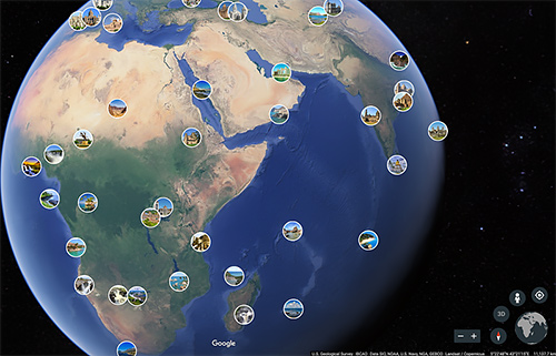
Google Earth Maps The World's Photos


19 September 2017
In a blog post today Google's Stafford Marquardt announced the company has released a global map of crowd-sourced photos in Google Earth.

Google Earth. Now with crowd-sourced photos.
And the instructions are pretty straight-forward:
To get started, open the Google Earth app on Android and iOS or go to Google Earth in your Chrome browser on desktop. Open the main menu and turn on the Photos toggle. As you explore the world and zoom in, relevant photos from each location will appear. Click on any thumbnail to see a full-screen version of the photo and then flip through related photos.
There's a catch, though. Your device has to support WebGL graphics acceleration.
Marquardt said you can add your own photos to the collection. To get the ball rolling, Google used "finely-tuned machine learning to pull the most beautiful and interesting photos from the millions and millions already shared in Google Maps by Local Guides and other contributors."